
Amsterdam could have had a Parisian-style boulevard.
Around the turn of the last century, the city council accepted proposals for a new commodity exchange. It initially favored a design sponsored by hotelier W.P. Werker, who would have demolished a whole street of buildings between the Dutch capital’s central railway station and the Royal Palace on the Dam Square to create something of a miniature Champs-Élysées.
The city abandoned the plan in 1892, when the national parliament decided it couldn’t expropriate so many private homeowners. Amsterdam’s politicians had to go back to the drawing board.

Commodity exchange
They still wanted a new commodity exchange, boulevard or not. The existing building, a neoclassical structure designed by Jan David Zocher, was widely disliked and had fallen into disrepair.
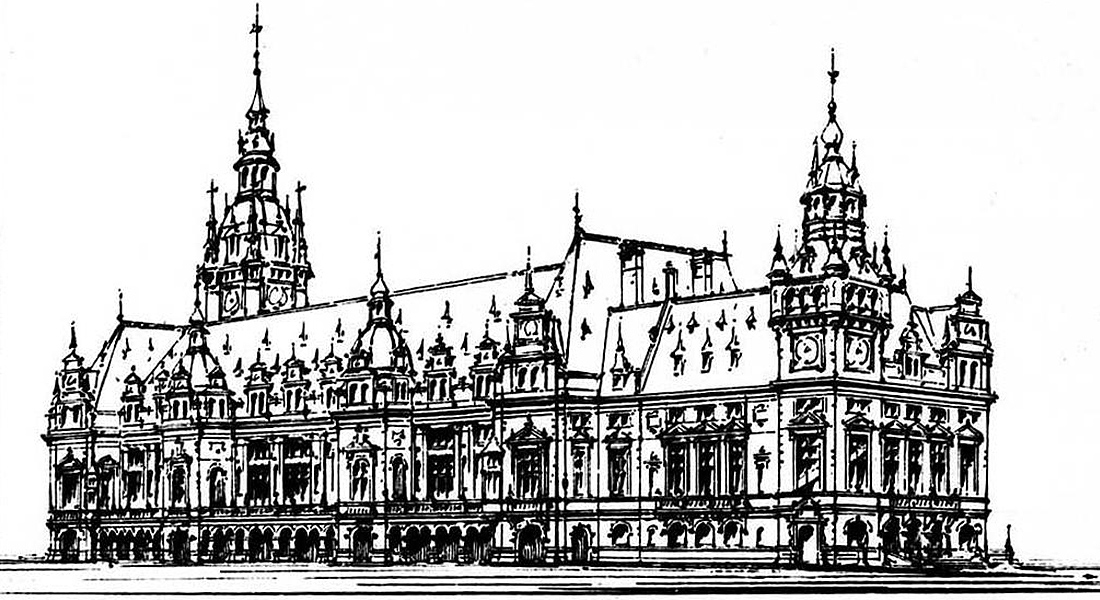

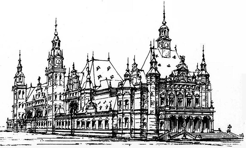

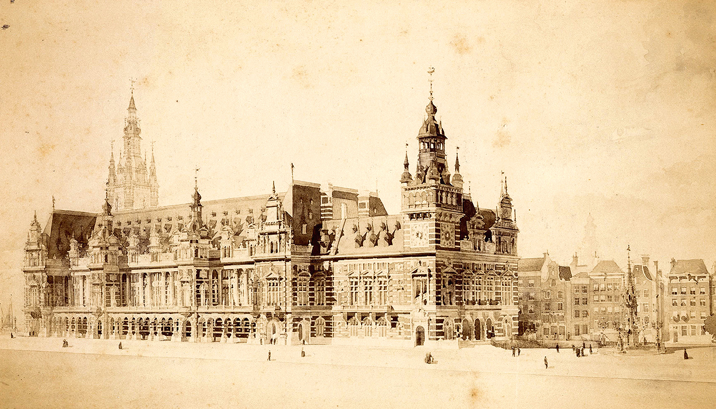
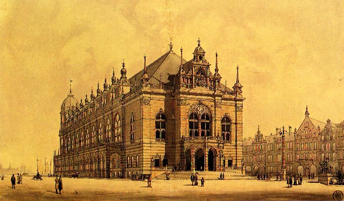
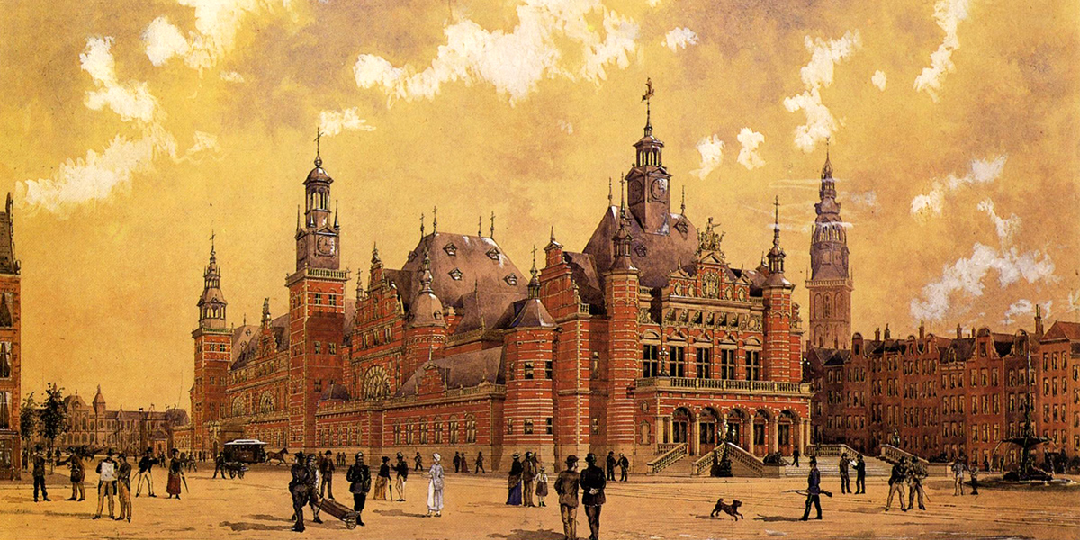
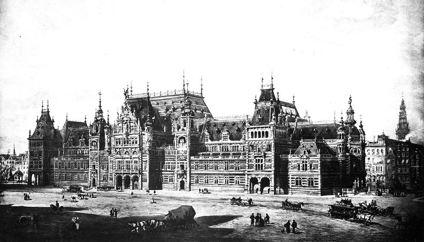
A competition had been held almost a decade earlier, but rather than fall back on one of the winning designs (displayed above), the city asked local architect Hendrik Petrus Berlage to take over the project.
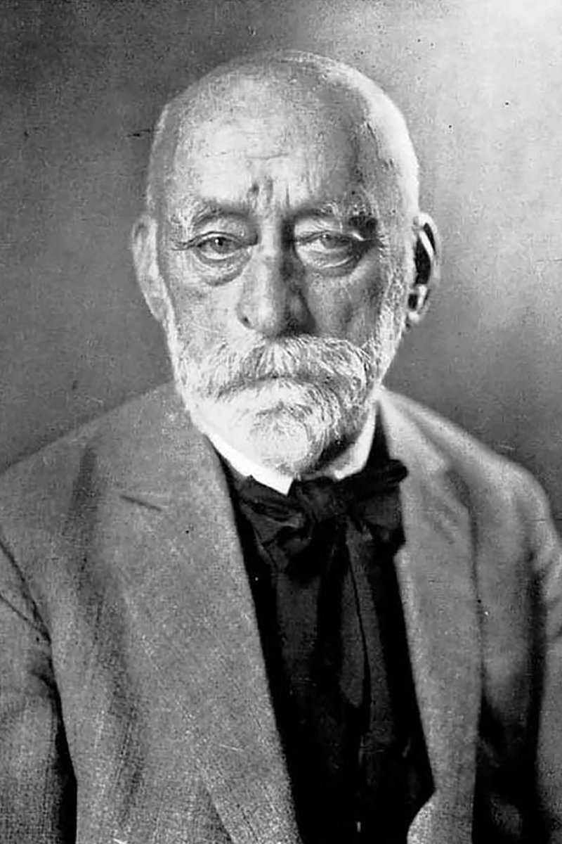
Berlage had originally entered his own design into the competition, but now his starting point was a blueprint by Adriaan Willem Weissman, a city official. Rather than mimic the Gothic Revival architecture of the Amsterdam train station and Rijksmuseum, Berlage drew on various styles for inspiration: Jugendstil, Romanesque, Traditionalist. The building would become an Amsterdam icon.
It only served as commodity exchange for a decade. By 1912, traders moved into yet another new home, this one designed by Joseph Cuypers, whose father, Pierre, had built Central Station and the Rijksmuseum.
City hall
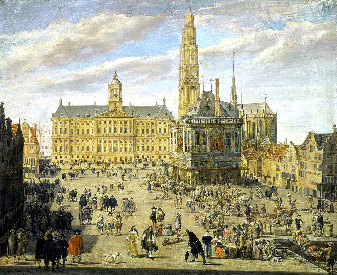
What is now a royal palace was built as the city hall of Amsterdam in the middle of the seventeenth century. The then-Dutch Republic was at the peak of its wealth and power, having secured its independence from Spain in the 1648 Peace of Westphalia and established itself as the trading entrepôt of Europe. Amsterdam was at the heart of the young country’s “Golden Century”.
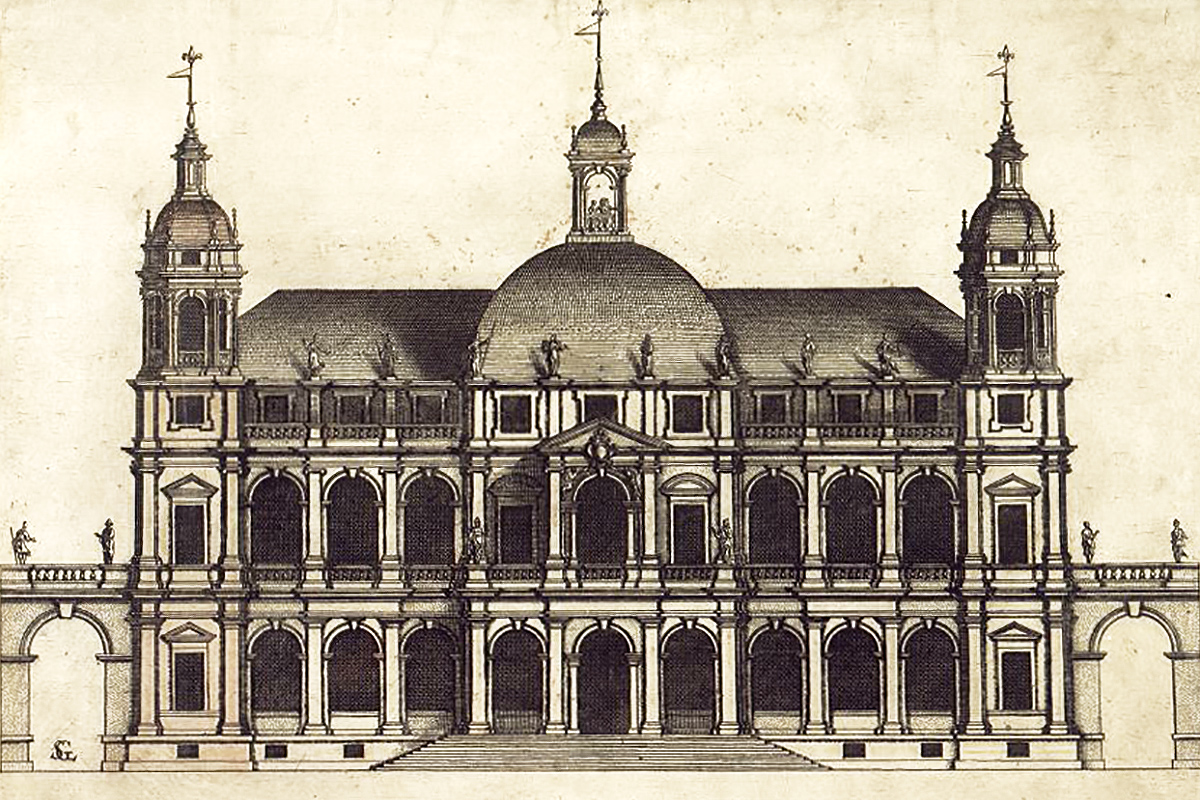
To celebrate their preeminent position, the oligarchs who ruled the city called for the construction of a new city hall. Out of the various designs that were submitted, they chose the most ambitious proposal, by Jacob van Campen. It would become the largest nonreligious building in Europe at the time.
It remained in use as city hall until 1808, when it was offered as residence to Napoleon’s younger brother, Louis Bonaparte, who had been sent to rule the Netherlands as king.
New Church tower
The New Church of Amsterdam was meant to get a tower to rival the Dom of Utrecht, then the country’s tallest. A foundation was laid in the sixteenth century, but by the time the city was finally ready to start construction a century later it was also building City Hall next door. It couldn’t afford both projects at the same time and once City Hall was completed, it was feared a church tower would overshadow the new pride of Amsterdam.
Greenbelt for the wealthy
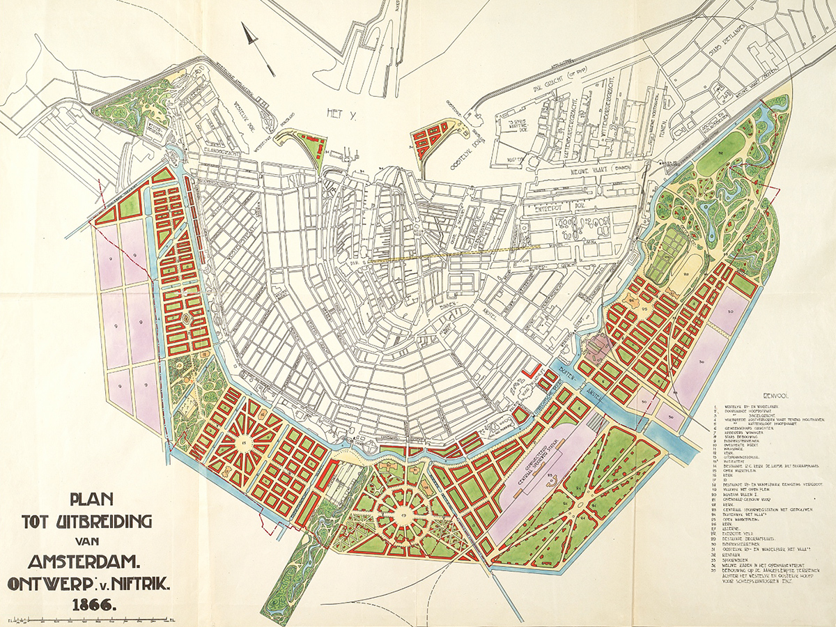
By the second half of the nineteenth century, Amsterdam was bursting at the seams. The city had barely expanded beyonds its seventeenth-century canal ring, but the population was growing rapidly. Years of neglect during the less prosperous first half of the century had reduced poor areas to shantytowns.
Jacobus van Niftrik, an engineer, proposed to address the problem by adding another ring to the city; something akin to a modern greenbelt. It would have been a playground for the wealthy, with broad boulevards, spacious villas and ample green space.
The city council turned down the plan on financial grounds. It wouldn’t be profitable to buy so much land from farmers only to turn it into parks.
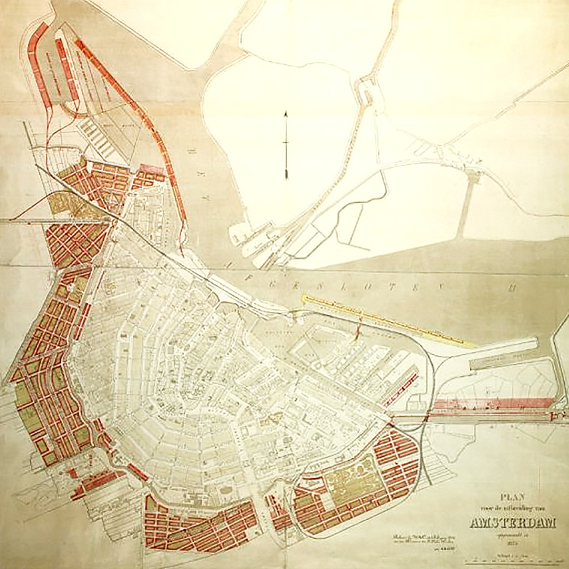
A decade later, Director of Public Works Jan Kalff revised Van Niftrik’s plan. There would be more, and more affordable, houses, along narrow and long streets, in order to alleviate pressure on the old city. Kalff’s plan was largely implemented.
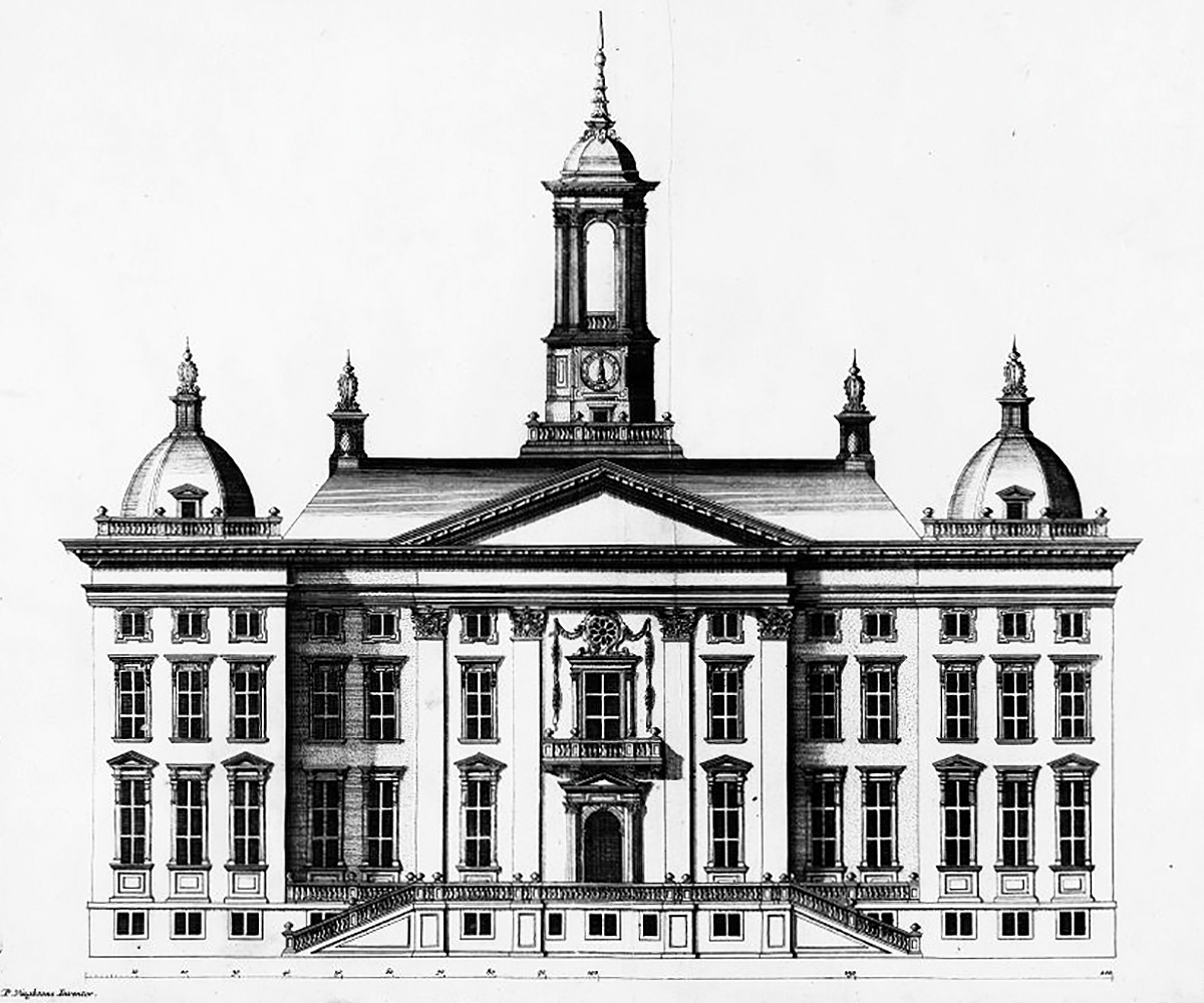
Paleis voor Volksvlijt
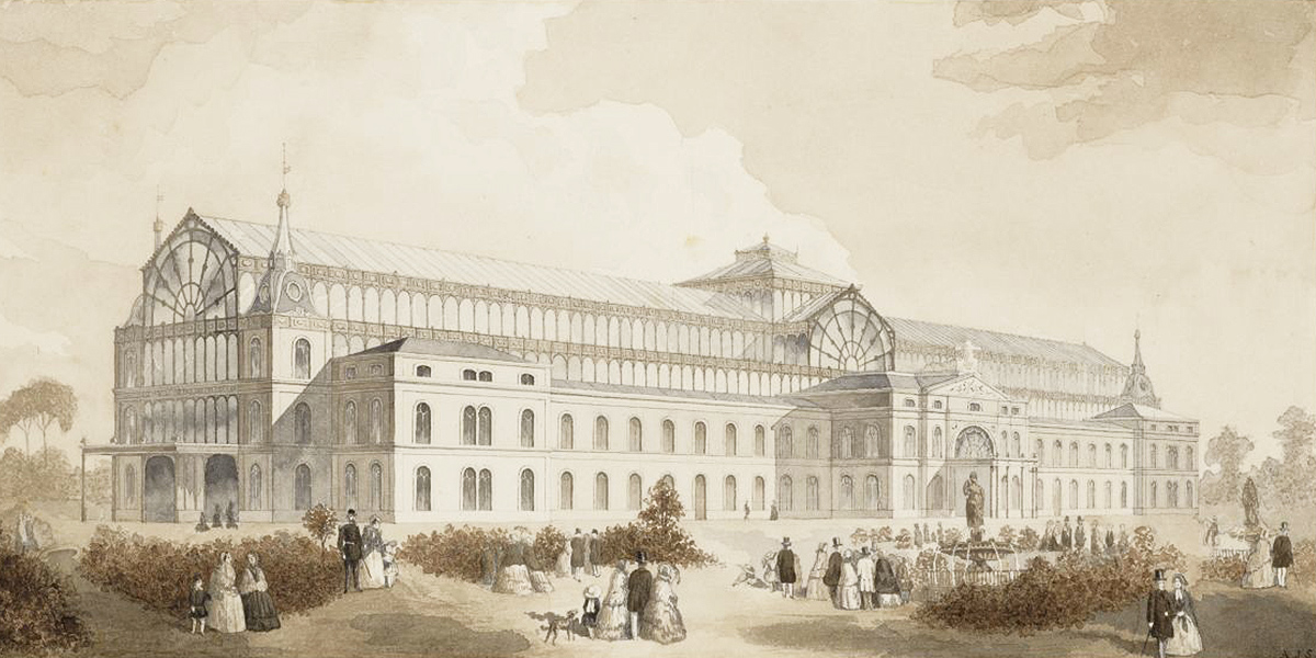
For the few decades of its existence, the Paleis voor Volksvlijt (“Palace of Popular Diligence”) was one of the most beloved buildings of Amsterdam. Constructed between 1859 and 1864, this Dutch version of the Crystal Palace was destroyed by fire in 1929.
Cornelis Outshoorn, who would go on to built the iconic Amstel Hotel a decade later, designed the palace after a competition held at the behest of doctor and city planner Samuel Sarphati in 1856-57 failed to produce a winner.
The image above is one of the unrealized designs, but I haven’t been able to find more information about it. If you know more, please let us know in the comments!
Bridge across the IJ
The first proposal for a bridge across the IJ dates from 1839. A developer from Monnickendam called Tijmon Kater suggested building a simple stone bridge, but the authorities in Amsterdam turned him down. Nobody lived across the river anyway. What did Amsterdam need a bridge for?
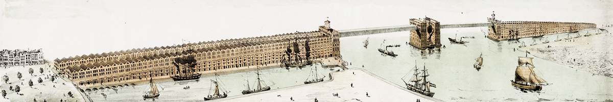
In the 1850s, Jan Galman developed his own plan. Inspired by the Ponte Vecchio in Florence, he called for the construction of two rows of houses on either side of the water with a gradually rising “bridge street” in between. The bridge itself would be modeled on London’s Tower Bridge.
Galman’s plan was rejected for fear of interrupting maritime traffic. To this day, that argument has prevailed against proposals for a bridge. Until the opening of the North/South metro line in 2018, the only way for pedestrians to cross the IJ was by ferry. (There are three tunnels for cars.)
Rijksmuseum
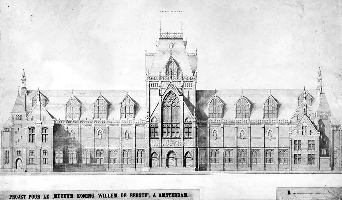
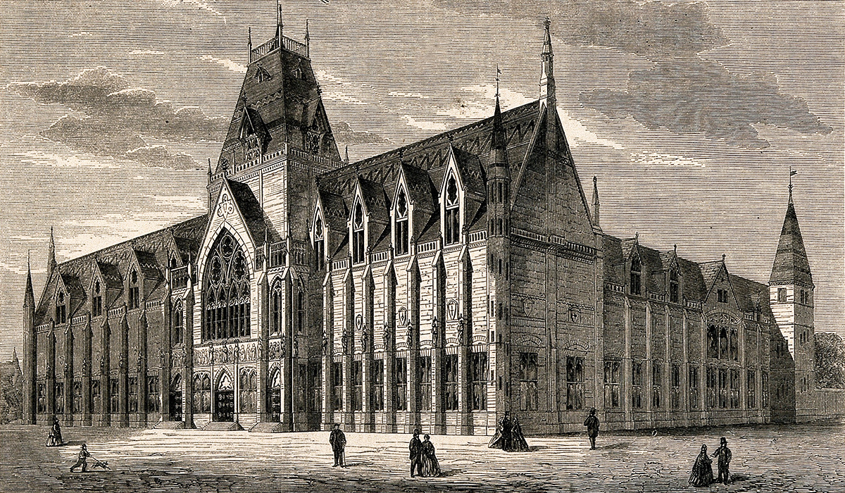
In 1863, a design competition was held for a new national museum in Amsterdam, then called the King William I Museum. Pierre Cuypers placed second with a Gothic design, but the jury decided that none of the submissions were good enough.
A decade later, a second contest was held and this time Cuypers won with a design that combined Gothic and Renaissance elements. What was by now called the Rijksmuseum was built between 1876 and 1885. Cuypers also designed Amsterdam’s central railway station.
Southern expansion
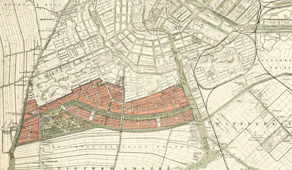
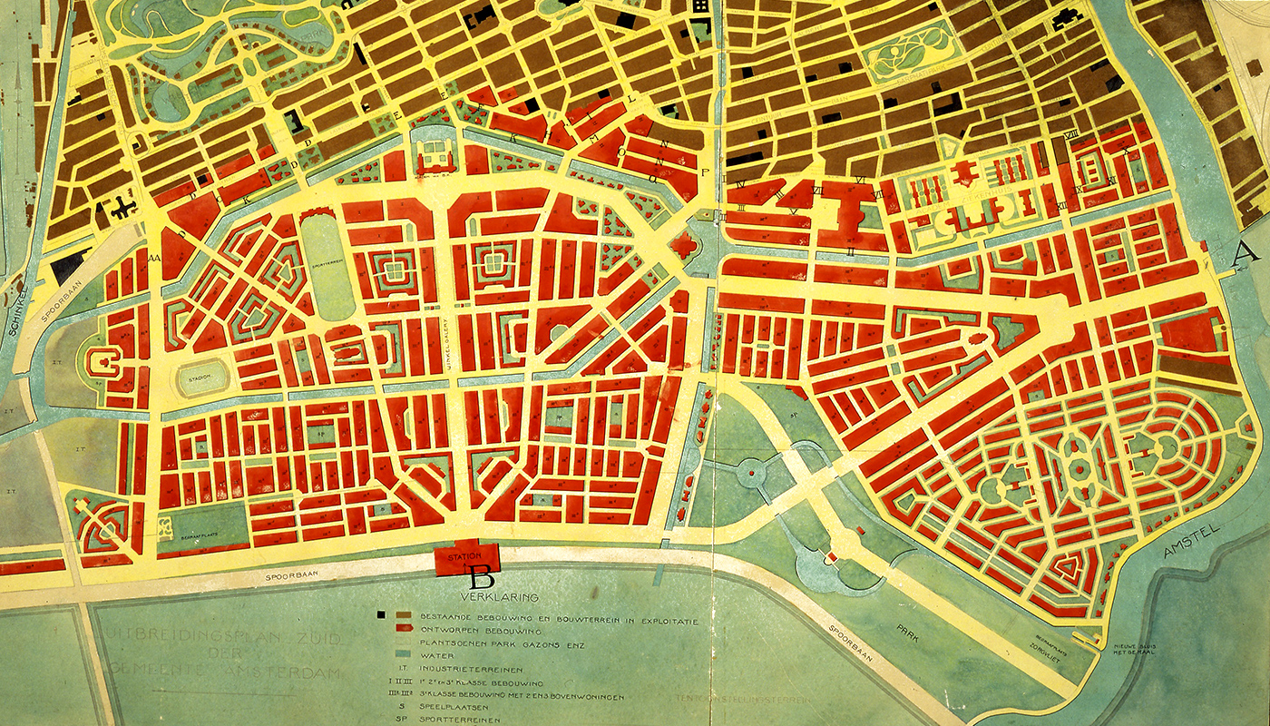
By the late 1800s, Amsterdam had again grown to its limits.
Constant Lodewijk Marius Lambrechtsen, an engineer and director of Public Works, drew up his own proposal for an expansion to the south before the city turned to Hendrik Petrus Berlage for a plan. It rejected his initial ideas in 1904 on the grounds that they were too expensive. The second, 1915 version of Berlage’s Plan Zuid had narrower streets and longer blocks, which would be cheaper to build.
The western half of the plan was largely implemented. The eastern section was significantly revised.
Towers in a park
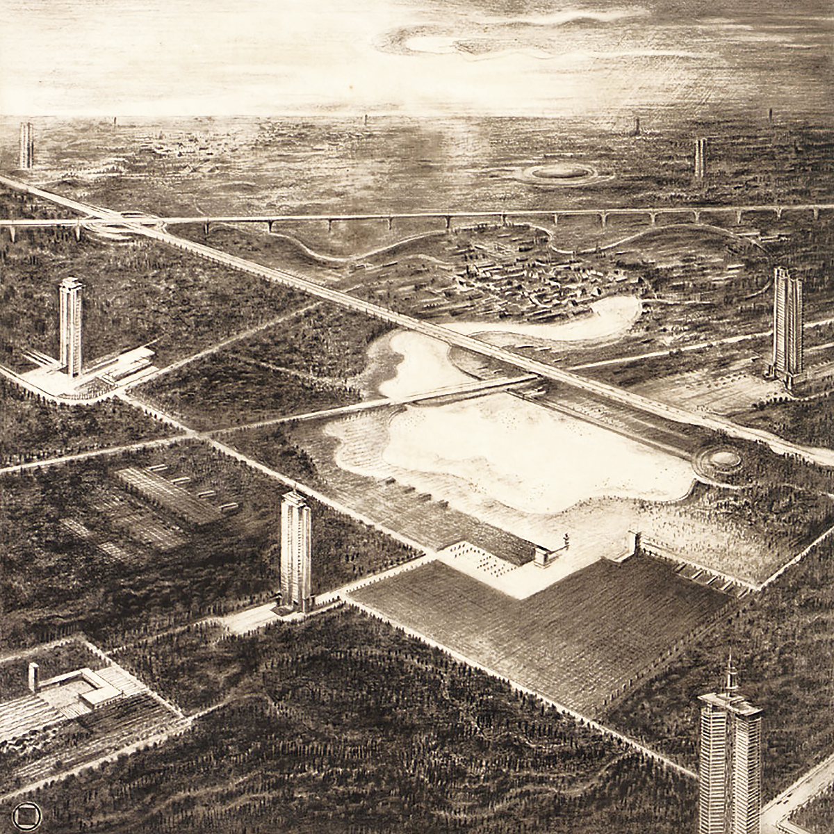
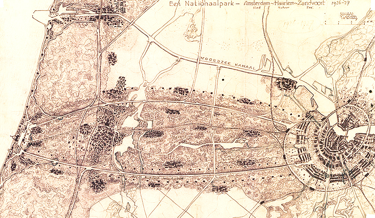
In the 1920s, architect Hendrik Wijdeveld worried that modern consumer culture and mass media were alienating man from nature. His solution: stop expanding existing cities and instead built a network of tower buildings, each a self-contained community, connected by roads and highways.
His towers would be built in two lines west of Amsterdam, connecting the city with the coastal resort town of Zandvoort. The area in between would be converted into a national park.
Western expansion
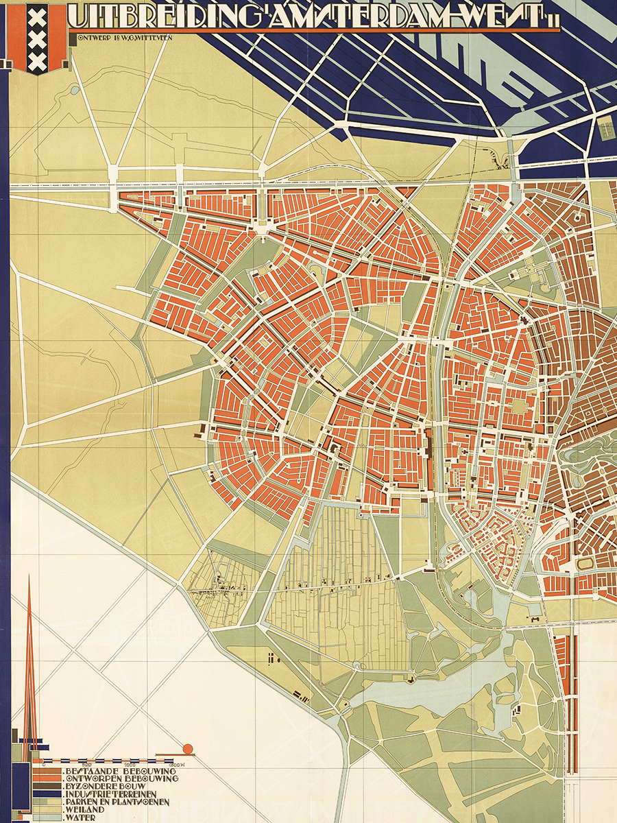
As Amsterdam expanded southward in the 1920s, it looked west for its future growth.
Before he moved to Rotterdam in 1924, Willem Gerrit Witteveen prepared a plan for the western expansion of Amsterdam that mirrored Berlage’s Plan Zuid. Nothing came of it.
A decade later, in 1935, the city adopted a General Expansion Plan, chiefly authored by Cornelis van Eesteren, that called for the construction of six “garden cities” around an artificial lake. It was implemented after the Second World War.
Cars first
While Amsterdam was building its garden cities to the west, Kalff’s legacy nearly fell victim to the same cars-first craze that destroyed so many cities in the United States.
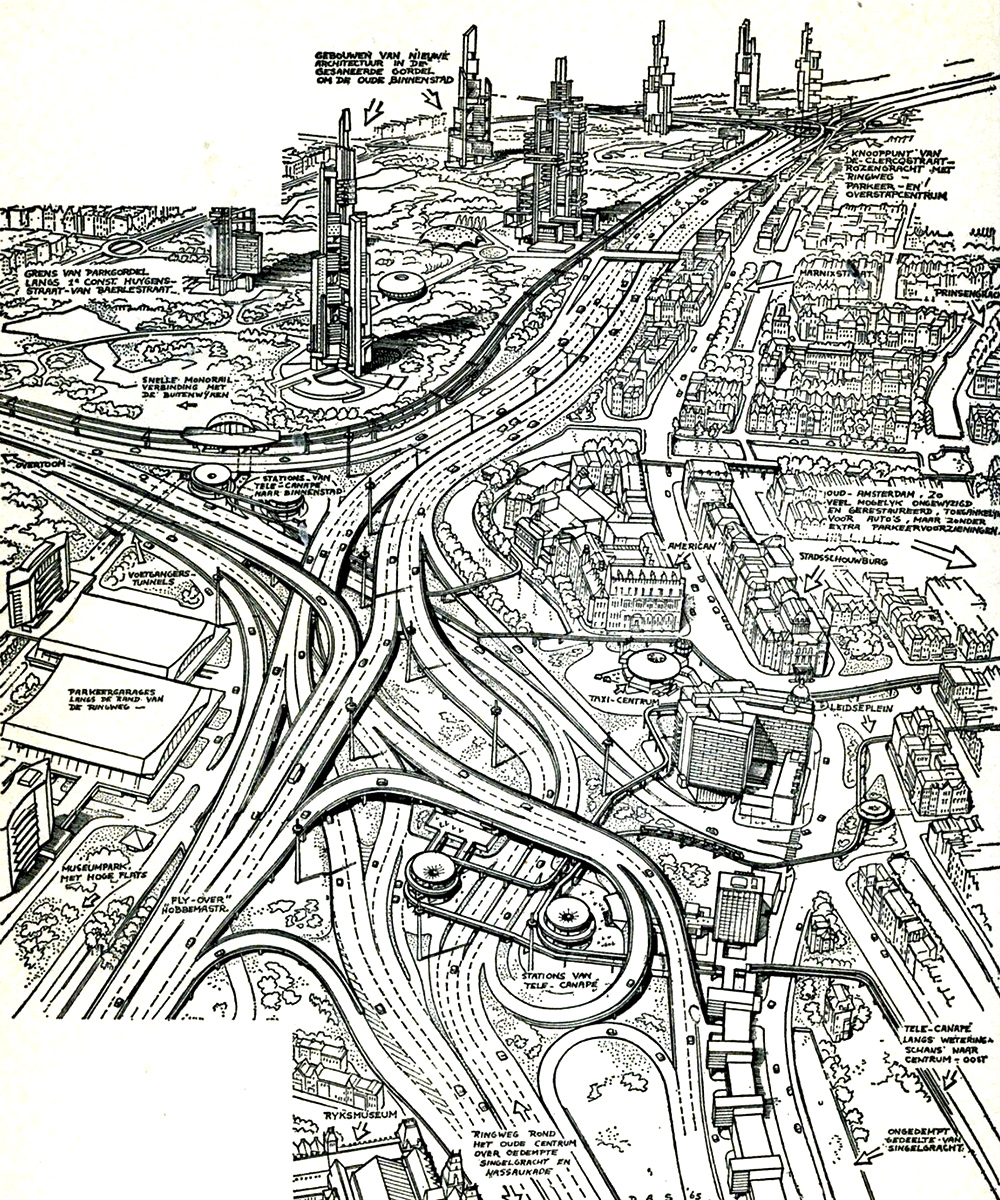
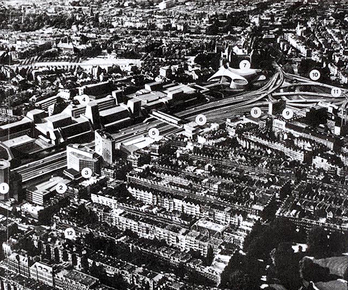
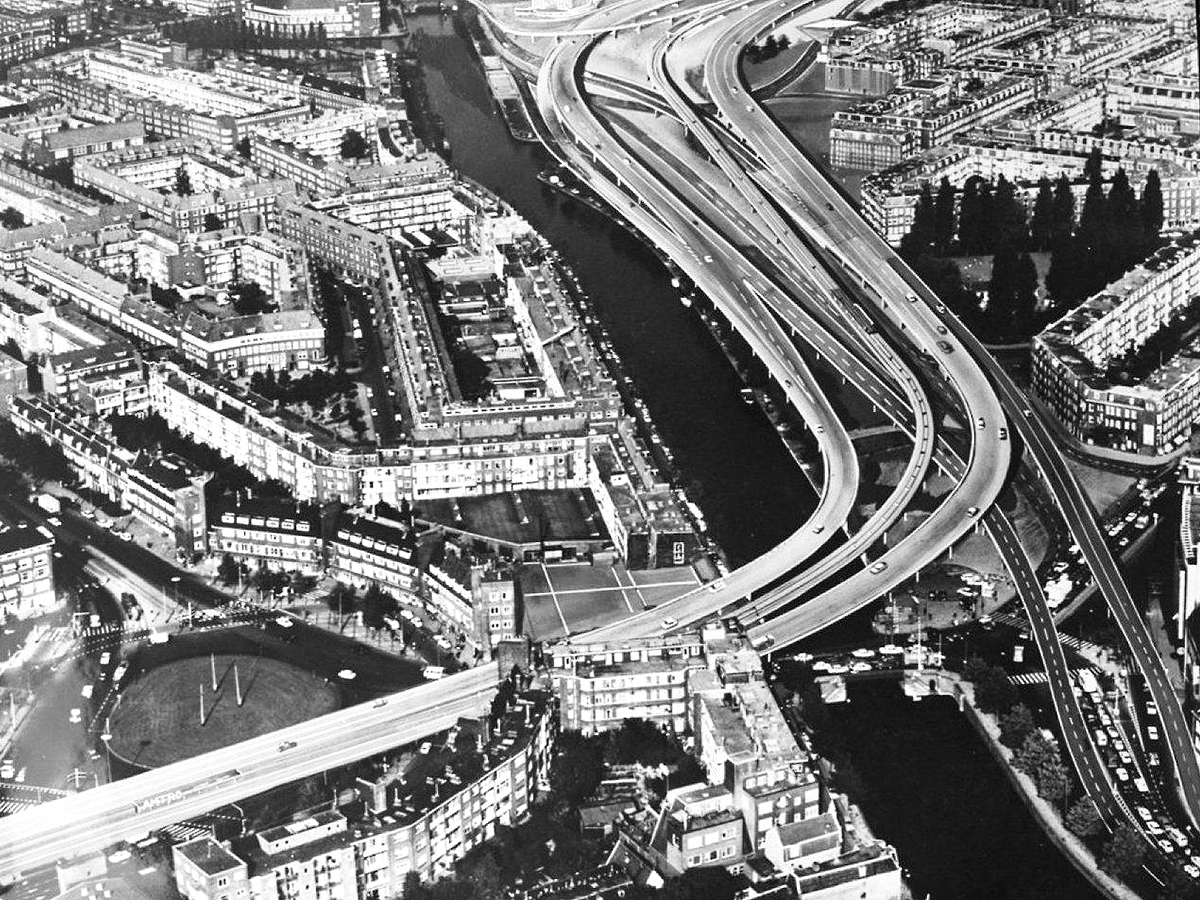
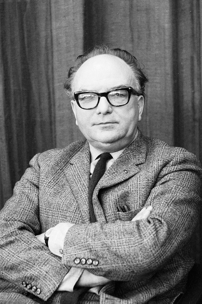
In 1967, American traffic expert David Jokinen contributed to a plan titled Give the City a Chance, which argued for the demolition of Amsterdam’s nineteenth-century neighborhoods in order to create room for highways that would connect the new areas to the south and west with the old city.
Amsterdammers were appalled and luckily so were their leaders. The mayor at the time called Jokinen’s proposal an “attack” on the city. The head of urban planning said he feared it would turn Amsterdam into “a pauperized American city” where people would “live and work next to traffic drains.”
One cute aspect of the plan: a system of monorails that could take commuters from large parking garages on the outskirts of the city into the center.
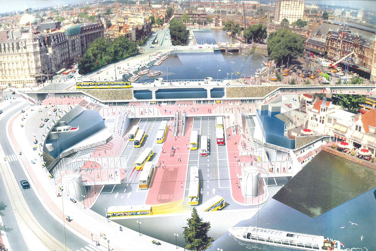
Manhattan on the IJ
The disappearance of the shipping industry conspired with white flight in the late 1980s to throw Amsterdam into a depression. Architect Teun Koolhaas introduced a proposal for the revitalization of the waterfront that would lift the whole city’s prospects. It was nicknamed “Manhattan on the IJ”.
Koolhaas’ relative, Rem, expanded on the plan, growing it into seven new islands in the IJ, housing office buildings and homes. A new bus terminal would be built underneath Amsterdam Central Station and a light rail line would tie the various parts of this “New Amsterdam” together.
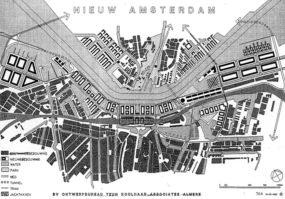
There was support for the idea, but ultimately cooler heads prevailed. The plan would demolish, rather than repurpose, industrial heritage: derelict factories and wharfs that have since been converted into office space and recreational areas. The “Manhattan” plan also threatened to segregate new high-income areas on the river from the old city. And it would be hugely expensive.
The south end of Amsterdam, or Zuidas, was a better place for a new commercial center. It was situated on the Amsterdam ring road and a new train station there connected directly to Schiphol Airport.
Plan Pampus
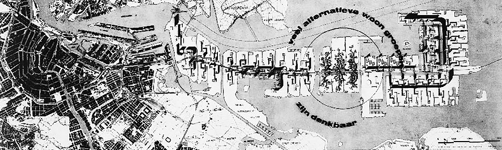
Another proposal for new land in the IJ was made by architect Jaap Bakema in 1965. His Plan Pampus called for several “city in a park”-like towers built on artificial islands east of Amsterdam, stretching all the way to the existing island fortress of Pampus and housing 350,000 people.
Bakema’s idea was rejected in favor of a garden city in the Bijlmermeer, which suffered the same fate as so many cookie-cutter high-rise neighborhoods built in postwar Europe: its cheap flats did not attract the native working class of Amsterdam but rather immigrants and welfare dependents, leading to high unemployment and crime. All but one of the Bijlmermeer’s Le Corbusier-like flats are slated to be demolished.
Meanwhile, a whole new neighborhood has been built on artificial islands in the mouth of the IJ, called IJburg — much like Bakema suggested half a century ago.


1 Comment
Add YoursSome very nice plans that sadly didnt happen and some very very bad plans that thankfully didnt happen.