Last year, we featured a map of North America from the title credits of Amazon’s The Man in the High Castle, which shows the United States divided into German and Japanese zones.
The second season of the series, which is also based on Philip K. Dick’s 1962 alternate-history novel and started streaming in December, gives us a fuller picture of the world.
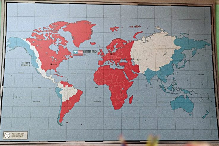
The first is a military map of the German and Japanese Empires in the early 1960s. It shows Germany has conquered the Atlantic area, including all of Africa, Europe and the Middle East. Japan has the entire Pacific Rim, including what used to be the American West Coast, parts of Central America, Chile and Peru.
Separating the empires, which are formally allied but really locked in a cold war, are an unruly Neutral Zone in North America, Mexico and a state called “Amazonia” in the middle of South America.
Central Asia is unconquered as well. Afghanistan and modern-day Pakistan appear as independent states.
A second map, which appears in an American high school in the second season’s first episode, shows the same division of the world, but there is something odd about it: the borders of many of the countries that exist in our world are still on it!
That’s even stranger when you remember that many of the republics in Africa didn’t win their independence until after the Second World War. So that’s an inconsistency, but I guess nobody was supposed to scrutinize these maps the way we do.


