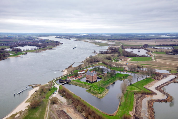
Situated on the confluence of the Meuse, Rhine and Scheldt Rivers, there is little but water that separates the Netherlands from its more powerful neighbors.
One way the country managed to safeguard its early independence was through clever diplomacy. The Dutch allied with the English against the Spanish, with the Danes and the French against the English, and with virtually all of Western Europe against the French.
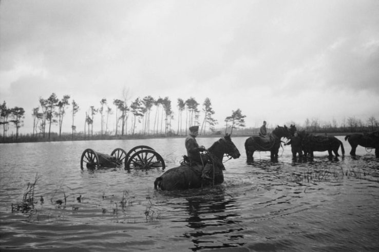
When this failed, their only recourse was to retreat north of the rivers and flood the low country southeast of Amsterdam in order to protect Holland’s commercial heartland from invasion.
This stopped the French in the Disaster Year of 1672, when the Dutch Republic was nearly overrun by the combined forces of England, France and two German electors.
But the system failed when the French invaded again in the winter of 1794-95 and the “Water Line” froze.
Defensive network

The Netherlands’ major cities and ports are located north of the Rhine-Meuse-Scheldt delta and behind a complex man-made network of waterways and reclaimed land, known in Dutch as polders.
During their war of independence from Spain, the Dutch realized they could use this geography to their advantage. Cities like Alkmaar and Leiden were relieved by destroying nearby dikes and flooding the surrounding countryside, enabling the Dutch fleet to sail in and break the Spanish siege.
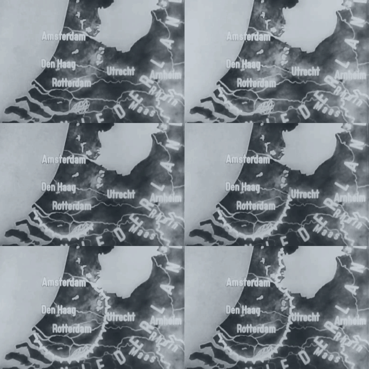
Work on the first Water Line began before the war with Spain ended in 1648. Between what was then the Zuiderzee in the north and the River Waal in the south, dikes, sluices and fortifications were built to allow the Dutch to control the water level in times of war: just deep enough to stall enemy troops, but shallow enough to prevent them from using boats (like the Dutch had themselves).
The system was modernized and expanded after the Napoleonic Wars to encompass the city of Utrecht. Gun positions were added later in the nineteenth century. A separate defense line, or stelling, was built around Amsterdam to create a national redoubt.
Fortress Holland in war
Airplanes and modern artillery rendered the system obsolete. Before the Dutch could even attempt a defense at the Water Line in 1940, the Germans bombed Rotterdam and forced the Netherlands to surrender.
When the tides turned four years later, there were fears the Germans would deliberately inundate large parts of the country to slow down the Allied advance.
Eelco van Kleffens, the foreign minister of the Dutch government in exile, warned Americans readers of Foreign Affairs that such a scheme would devastate his country. The outlook for Holland, he wrote, would be blacker than for any other nation occupied by Germany. If the Nazis went through with it — and Van Kleffens had little doubt they would; “the Nazis have a complete disregard for the rights and welfare of other nations” — the Netherlands would demand territorial compensation in the east.
(Such proposals to seize German land were made after the war, but very little came of them.)
In the end, the Germans only flooded part of the defensive line north of Amsterdam to guard against a possible invasion by sea. An invasion that never came. It were the natural waterways in the center of the country that slowed the Allies down. Operation Market Garden, immortalized in Richard Attenborough’s A Bridge Too Far (1977), failed to push the Nazis out in one fell swoop. The north of the Netherlands would have to wait until the spring of 1945 for liberation.


